
Ports
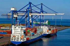 The Port of Virginia offers one of the largest intermodal networks on the East Coast, handling 3.287 million TEUs (Twenty-Foot Equivalent Units) in 2023, and moving more than 36.7% of its total business by rail. The Port of Virginia operates six terminals.
The Newport News Marine Terminal is the Virginia Port Authority’s main break-bulk and roll-on/roll-off facility.
- Total Area: 165 acres
- Outside Storage: 60 acres
- Berth Space: 3,480 Feet
- Depth: 40 Feet
- Land Access: I-664, US17
- Rail: CSX
- Water Access: James River
- Distance from Mecklenburg County: 140 miles
Norfolk International Terminals (NIT) is located in the Hampton Roads Harbor and is the Virginia Port Authority’s largest terminal.
- Total Area: 567 acres (operating 378 acres)
- Berth Space: 6,630 LF
- Depth: 50 Feet
- Land Access: I-64, I-564, SR164
- Rail: Norfolk Southern, CSX
- Water Access: Elizabeth River
- Cranes: 14 Super Post-Panamax
- Distance from Mecklenburg County: 139 miles
The Portsmouth Marine Terminal is able to handle containers, break-bulk, roll-on/roll-off cargo, and is a premier offshore wind staging port.
- Total Area: 287 acres
- Wharf Length: 3,540 Feet
- Land Access: I-264, I-664, SR164
- Rail: CSX, Norfolk Southern, Norfolk Portsmouth Beltline
- Water Access: Elizabeth River
- Distance from Mecklenburg County: 133 miles
The Virginia Inland Port is an intermodal container transfer facility located approximately 60 miles west of Washington, D.C. It brings the Port of Virginia 220 miles closer to inland markets. It also consolidates and containerizes local cargo for export.
- Total Area: 161 acres
- Land Access: I-66, I-81
- Rail: Norfolk Southern
- Distance from Mecklenburg County: 229 miles
The Virginia International Gateway is the largest privately owned marine container terminal in the United States and one of the only functional automated container terminals in the Western Hemisphere. It was constructed as a semi-automated operation, with a mix of manual and automated container handling equipment. Many of the terminal’s operations are performed from a centralized terminal operations center.
- Total Area: 576 acres (operating 231 acres)
- Berth Space: 4,000 Feet
- Land Access: I-64, I-664, SR164
- Rail: Commonwealth Railway, Norfolk Southern, CSX
- Water Access: Elizabeth River
- Cranes: 12 Super Post-Panamax
- Distance from Mecklenburg County: 135 miles
The Richmond Marine Terminal is available for berthing and handling containers, temperature controlled containers, break-bulk, and neo-bulk cargo.
- Total Area: 121 acres
- Wharf Length: 1,570 LF
- Land Access: I-95
- Rail: CSX, Norfolk Southern
- Water Access: James River
- Cranes: 1 Manitowoc Crawler Crane and 1 Liebherr LHM 420 Crane
- Barge: James River Barge Service
- Distance from Mecklenburg County: 96 miles
The future Craney Island Marine Terminal will be a state-of-the-art container facility with the capability to handle up to 50 percent of its total volume by rail. It will be designed to handle ultra-large container vessels, direct interchange to the interstate highway system, and double-stack intermodal rail service. The terminal will be planned as a semi-automated operation with a mix of manual and automated container handling equipment.
For more information on the Port of Virginia and its terminals, visit their website at PortOfVirginia.com >
Customs information and regulations may be found on the U.S. Customs Service Web Site, CBP.gov >
Other Ports of Entry
| Name | Distance |
| Raleigh-Durham | 74 miles |
| Port of Washington – Dulles | 211 miles |
* Note: Driving distance from the center of the locality/region to Port of Washington – Dulles and any other port of entry within 100 miles.